
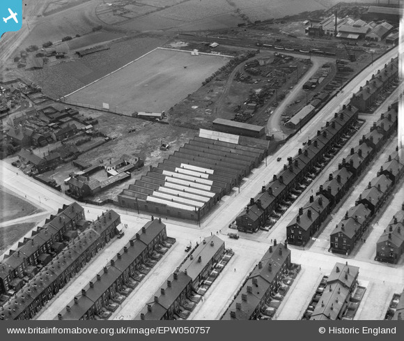
EPW050757 ENGLAND (1936). The Samuel Driver Ltd works and the surrounding residential area, Hunslet, 1936
© Copyright OpenStreetMap contributors and licensed by the OpenStreetMap Foundation. 2024. Cartography is licensed as CC BY-SA.
Nearby Images (8)
EPW050757

EPW050754

EPW050759

EPW050758

EPW050760

EPW050761

EPW050756

EPW050755

Details
| Title | [EPW050757] The Samuel Driver Ltd works and the surrounding residential area, Hunslet, 1936 |
| Reference | EPW050757 |
| Date | June-1936 |
| Link | |
| Place name | HUNSLET |
| Parish | |
| District | |
| Country | ENGLAND |
| Easting / Northing | 430325, 431125 |
| Longitude / Latitude | -1.5398007756742, 53.775359439455 |
| National Grid Reference | SE303311 |
Pins
Be the first to add a comment to this image!


