
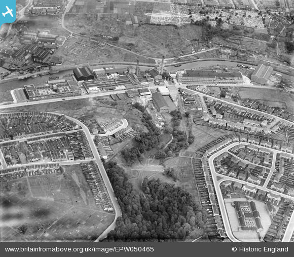
EPW050465 ENGLAND (1936). St Anne's Board Mill Co Ltd Works and environs, Bristol, 1936
© Copyright OpenStreetMap contributors and licensed by the OpenStreetMap Foundation. 2024. Cartography is licensed as CC BY-SA.
Nearby Images (26)
EPW050465

EPW060111

EPW060113

EPW060112

EPW050565

EPW060114

EPW050468

EPW050571

EPW050469

EPW060105

EPW060109

EPW050562

EPW060106

EPW050566

EPW050567

EPW050561

EPW005538

EPW050464

EPW050470

EPW060115

EPW050557

EPW050570

EPW060110

EPW050467

EPW060107

EPW050572

Details
| Title | [EPW050465] St Anne's Board Mill Co Ltd Works and environs, Bristol, 1936 |
| Reference | EPW050465 |
| Date | June-1936 |
| Link | |
| Place name | BRISTOL |
| Parish | |
| District | |
| Country | ENGLAND |
| Easting / Northing | 362135, 172746 |
| Longitude / Latitude | -2.5449862338549, 51.451940658588 |
| National Grid Reference | ST621727 |
Pins
 Alan |
Monday 15th of December 2014 11:30:46 PM |


