
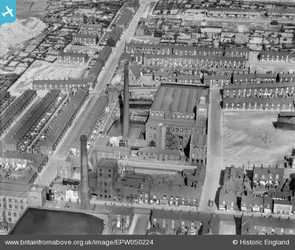
EPW050224 ENGLAND (1936). Coldhurst Hall Cotton Mill, Magdala Street and environs, Oldham, 1936
© Copyright OpenStreetMap contributors and licensed by the OpenStreetMap Foundation. 2024. Cartography is licensed as CC BY-SA.
Nearby Images (20)
EPW050224

EPW050228

EPW050226

EPW050227

EPW050225

EAW004276

EAW004280

EPW050229

EAW004277

EAW004281

EAW004278

EAW004279

EAW004431

EAW004430

EAW004434

EAW004432

EAW004435

EAW004433

EAW004429

EAW004436

Details
| Title | [EPW050224] Coldhurst Hall Cotton Mill, Magdala Street and environs, Oldham, 1936 |
| Reference | EPW050224 |
| Date | May-1936 |
| Link | |
| Place name | OLDHAM |
| Parish | |
| District | |
| Country | ENGLAND |
| Easting / Northing | 392264, 405921 |
| Longitude / Latitude | -2.1167722212202, 53.549621368005 |
| National Grid Reference | SD923059 |
Pins
 eddief |
Thursday 19th of September 2013 10:51:11 PM | |
eddief |
Thursday 19th of September 2013 10:50:29 PM | |
eddief |
Thursday 19th of September 2013 10:46:31 PM | |
eddief |
Thursday 19th of September 2013 10:45:57 PM | |
eddief |
Thursday 19th of September 2013 10:44:49 PM | |
eddief |
Thursday 19th of September 2013 10:43:31 PM | |
eddief |
Thursday 19th of September 2013 10:43:00 PM | |
eddief |
Thursday 19th of September 2013 10:42:15 PM | |
eddief |
Thursday 19th of September 2013 10:36:49 PM | |
eddief |
Thursday 19th of September 2013 10:36:12 PM | |
eddief |
Thursday 19th of September 2013 10:35:43 PM |


