
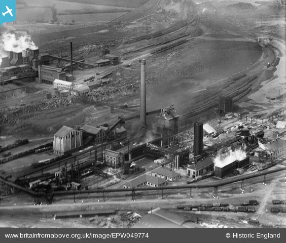
EPW049774 ENGLAND (1936). The By-Product Plant at the Iron and Steel Works, Corby, 1936
© Copyright OpenStreetMap contributors and licensed by the OpenStreetMap Foundation. 2024. Cartography is licensed as CC BY-SA.
Nearby Images (21)
EPW049774

EPW049775

EAW034123

EAW034116

EAW034119

EPW054913

EAW034115

EAW034117

EAW034113

EAW034120

EPW049771

EAW034114

EAW034121

EPW049770

EAW034118

EPW049772

EPW054923

EAW045454
, Corby, from the south-east, 1952")
EPW054912

EPW049767

EAW045439

Details
| Title | [EPW049774] The By-Product Plant at the Iron and Steel Works, Corby, 1936 |
| Reference | EPW049774 |
| Date | March-1936 |
| Link | |
| Place name | CORBY |
| Parish | |
| District | |
| Country | ENGLAND |
| Easting / Northing | 489908, 289471 |
| Longitude / Latitude | -0.67552765397382, 52.495359517982 |
| National Grid Reference | SP899895 |
Pins
Be the first to add a comment to this image!


