
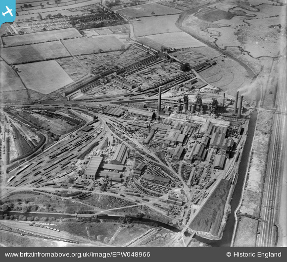
EPW048966 ENGLAND (1935). The Stanton Iron Works, Hallam Fields, 1935
© Copyright OpenStreetMap contributors and licensed by the OpenStreetMap Foundation. 2024. Cartography is licensed as CC BY-SA.
Nearby Images (6)
EPW048966

EPW048965

EPW048973

EPW048975

EPW048974

EPW048964

Details
| Title | [EPW048966] The Stanton Iron Works, Hallam Fields, 1935 |
| Reference | EPW048966 |
| Date | August-1935 |
| Link | |
| Place name | HALLAM FIELDS |
| Parish | |
| District | |
| Country | ENGLAND |
| Easting / Northing | 447802, 339315 |
| Longitude / Latitude | -1.2884789963471, 52.948771453053 |
| National Grid Reference | SK478393 |
Pins
 phillrooney |
Sunday 31st of August 2014 03:34:58 PM | |
phillrooney |
Sunday 31st of August 2014 03:34:15 PM | |
phillrooney |
Sunday 31st of August 2014 03:33:26 PM | |
phillrooney |
Sunday 31st of August 2014 03:32:40 PM | |
phillrooney |
Sunday 31st of August 2014 03:32:00 PM | |
phillrooney |
Sunday 31st of August 2014 03:31:25 PM | |
phillrooney |
Sunday 31st of August 2014 03:31:05 PM | |
phillrooney |
Sunday 31st of August 2014 03:30:43 PM | |
phillrooney |
Sunday 31st of August 2014 03:30:21 PM | |
phillrooney |
Sunday 31st of August 2014 03:29:49 PM | |
phillrooney |
Sunday 31st of August 2014 03:29:07 PM | |
phillrooney |
Sunday 31st of August 2014 03:28:39 PM | |
phillrooney |
Sunday 31st of August 2014 03:28:22 PM |


