
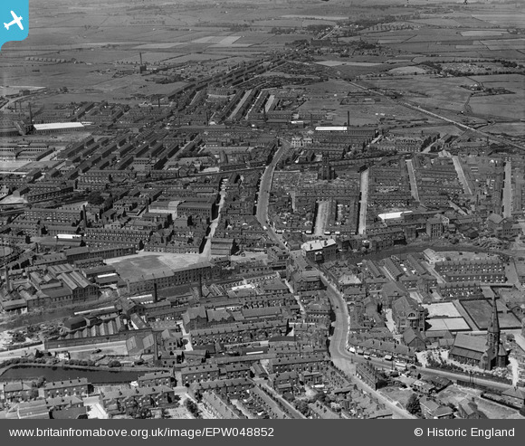
EPW048852 ENGLAND (1935). The town centre, Radcliffe, 1935
© Copyright OpenStreetMap contributors and licensed by the OpenStreetMap Foundation. 2024. Cartography is licensed as CC BY-SA.
Nearby Images (3)
EPW048852

EPW046165

EPW046168

Details
| Title | [EPW048852] The town centre, Radcliffe, 1935 |
| Reference | EPW048852 |
| Date | August-1935 |
| Link | |
| Place name | RADCLIFEE |
| Parish | |
| District | |
| Country | ENGLAND |
| Easting / Northing | 378494, 407085 |
| Longitude / Latitude | -2.3247031730235, 53.559701312108 |
| National Grid Reference | SD785071 |
Pins
 Moonraker |
Sunday 22nd of October 2023 09:09:51 PM | |
Moonraker |
Sunday 22nd of October 2023 09:07:54 PM | |
Moonraker |
Sunday 22nd of October 2023 09:03:36 PM | |
Moonraker |
Sunday 22nd of October 2023 08:47:09 PM | |
Moonraker |
Sunday 22nd of October 2023 08:41:53 PM | |
Moonraker |
Sunday 22nd of October 2023 08:36:53 PM | |
Moonraker |
Sunday 22nd of October 2023 08:31:44 PM | |
Moonraker |
Sunday 22nd of October 2023 08:29:33 PM | |
Moonraker |
Sunday 22nd of October 2023 08:23:26 PM | |
Moonraker |
Sunday 22nd of October 2023 08:15:35 PM | |
Moonraker |
Sunday 22nd of October 2023 08:00:36 PM | |
Moonraker |
Sunday 22nd of October 2023 07:56:28 PM | |
Moonraker |
Sunday 22nd of October 2023 07:09:14 PM | |
Moonraker |
Sunday 22nd of October 2023 07:03:08 PM | |
Moonraker |
Sunday 22nd of October 2023 06:56:28 PM | |
Moonraker |
Sunday 22nd of October 2023 06:55:23 PM | |
parrot |
Sunday 18th of April 2021 03:54:38 PM | |
boltie |
Tuesday 15th of March 2016 04:57:40 AM | |
boltie |
Tuesday 15th of March 2016 04:55:51 AM | |
 Dylan Moore |
Sunday 5th of May 2013 08:58:17 PM | |
Dylan Moore |
Sunday 5th of May 2013 08:57:43 PM | |
Dylan Moore |
Sunday 5th of May 2013 08:57:11 PM | |
Sorry I am new to the site so may not do things quite right, I have made a comment about the Stand Lane tag Hope this is OK |
Sheila |
Wednesday 11th of March 2015 09:38:59 AM |
Dylan Moore |
Sunday 5th of May 2013 08:53:37 PM | |
Dylan Moore |
Sunday 5th of May 2013 08:51:27 PM | |
Dylan Moore |
Sunday 5th of May 2013 08:50:50 PM | |
Dylan Moore |
Sunday 5th of May 2013 08:49:57 PM | |
Dylan Moore |
Sunday 5th of May 2013 08:48:49 PM | |
Dylan Moore |
Sunday 5th of May 2013 08:48:27 PM | |
Dylan Moore |
Sunday 5th of May 2013 08:45:37 PM | |
Dylan Moore |
Sunday 5th of May 2013 08:44:24 PM | |
Dylan Moore |
Sunday 5th of May 2013 08:38:31 PM | |
Dylan Moore |
Sunday 5th of May 2013 08:35:38 PM | |
Dylan Moore |
Sunday 5th of May 2013 08:34:54 PM | |
Dylan Moore |
Sunday 5th of May 2013 08:31:05 PM | |
Dylan Moore |
Sunday 5th of May 2013 08:28:55 PM | |
Dylan Moore |
Sunday 5th of May 2013 08:28:19 PM | |
Dylan Moore |
Sunday 5th of May 2013 08:21:18 PM | |
Dylan Moore |
Sunday 5th of May 2013 08:20:27 PM | |
Dylan Moore |
Sunday 5th of May 2013 08:19:45 PM | |
Dylan Moore |
Sunday 5th of May 2013 08:18:02 PM | |
Dylan Moore |
Sunday 5th of May 2013 08:17:21 PM | |
Dylan Moore |
Sunday 5th of May 2013 08:16:44 PM | |
Dylan Moore |
Sunday 5th of May 2013 08:15:28 PM | |
Dylan Moore |
Sunday 5th of May 2013 08:15:01 PM | |
Dylan Moore |
Sunday 5th of May 2013 08:13:39 PM | |
Dylan Moore |
Sunday 5th of May 2013 08:10:35 PM | |
Dylan Moore |
Sunday 5th of May 2013 08:09:17 PM | |
Dylan Moore |
Sunday 5th of May 2013 08:08:08 PM | |
Dylan Moore |
Sunday 5th of May 2013 08:06:29 PM | |
Dylan Moore |
Sunday 5th of May 2013 08:05:11 PM | |
Dylan Moore |
Sunday 5th of May 2013 08:04:40 PM | |
Dylan Moore |
Sunday 5th of May 2013 08:03:21 PM | |
Dylan Moore |
Sunday 5th of May 2013 08:02:16 PM | |
Dylan Moore |
Sunday 5th of May 2013 08:01:50 PM | |
Dylan Moore |
Sunday 5th of May 2013 07:58:32 PM | |
Dylan Moore |
Sunday 5th of May 2013 07:57:52 PM | |
Dylan Moore |
Sunday 5th of May 2013 07:54:25 PM | |
Dylan Moore |
Sunday 5th of May 2013 07:53:48 PM |
User Comment Contributions
I am looking for Outwood Road on the 1935 map and think that the tag for Stand Lane is actually Outwood Road, Stand Lane is the road opposite Radcliffe New Road on the 3 point junction. I may be wrong but I doubt it. Hope none minds this comment |
Sheila |
Wednesday 11th of March 2015 09:36:57 AM |
Hi Dylan, thank you for identifying the location of this image. We'll update the catalogue and post the new record here in due course. Yours, Katy Britain from Above Cataloguing Team Leader |
Katy Whitaker |
Tuesday 2nd of July 2013 03:10:33 PM |


