
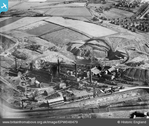
EPW048479 ENGLAND (1935). The Nunnery Colliery, Sheffield, 1935
© Copyright OpenStreetMap contributors and licensed by the OpenStreetMap Foundation. 2024. Cartography is licensed as CC BY-SA.
Nearby Images (9)
EPW048479

EPW048473

EPW048476

EPW048480

EPW048477

EPW048475

EPW048474

EPW048478

EPW048472

Details
| Title | [EPW048479] The Nunnery Colliery, Sheffield, 1935 |
| Reference | EPW048479 |
| Date | July-1935 |
| Link | |
| Place name | SHEFFIELD |
| Parish | |
| District | |
| Country | ENGLAND |
| Easting / Northing | 437751, 387598 |
| Longitude / Latitude | -1.4323781770712, 53.383614263949 |
| National Grid Reference | SK378876 |
Pins
 Mick. |
Tuesday 8th of June 2021 06:28:47 PM | |
Mick. |
Tuesday 8th of June 2021 06:28:09 PM | |
Mick. |
Tuesday 8th of June 2021 06:26:51 PM | |
Mick. |
Tuesday 8th of June 2021 06:26:28 PM | |
Mick. |
Tuesday 8th of June 2021 06:26:12 PM | |
Mick. |
Tuesday 8th of June 2021 06:25:02 PM |


