
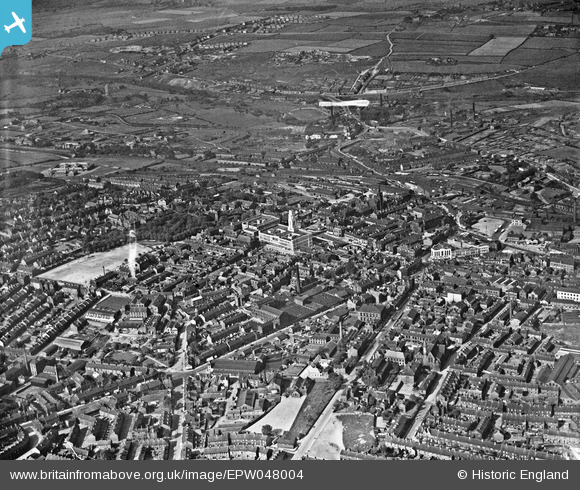
EPW048004 ENGLAND (1935). The town centre, Barnsley, from the south-west, 1935
© Copyright OpenStreetMap contributors and licensed by the OpenStreetMap Foundation. 2024. Cartography is licensed as CC BY-SA.
Nearby Images (15)
EPW048004

EPW021099

EPW055897

EPW021103

EPW021100

EPW057293

EPW057288

EAW009218

EPW057290

EAW024171

EAW009214

EPW061491

EAW009219

EPW055899

EPW055898

Details
| Title | [EPW048004] The town centre, Barnsley, from the south-west, 1935 |
| Reference | EPW048004 |
| Date | June-1935 |
| Link | |
| Place name | BARNSLEY |
| Parish | |
| District | |
| Country | ENGLAND |
| Easting / Northing | 434198, 406306 |
| Longitude / Latitude | -1.4837619220395, 53.552025236642 |
| National Grid Reference | SE342063 |
Pins
 klowe |
Wednesday 9th of May 2018 09:29:23 PM | |
HOLMES |
Wednesday 18th of November 2015 11:25:17 PM | |
nicebaz |
Monday 4th of November 2013 12:41:33 PM | |
2 jam jars could get you in on Saturday morning. Those were the days |
Norman |
Wednesday 21st of December 2016 08:07:15 PM |
nicebaz |
Wednesday 8th of May 2013 09:16:03 AM | |
nicebaz |
Wednesday 8th of May 2013 09:15:06 AM | |
nicebaz |
Wednesday 8th of May 2013 09:14:04 AM | |
nicebaz |
Wednesday 8th of May 2013 09:13:18 AM | |
nicebaz |
Wednesday 8th of May 2013 09:12:42 AM | |
nicebaz |
Wednesday 8th of May 2013 09:12:11 AM | |
nicebaz |
Wednesday 8th of May 2013 09:11:45 AM | |
nicebaz |
Wednesday 8th of May 2013 09:11:24 AM | |
nicebaz |
Wednesday 8th of May 2013 09:10:34 AM | |
nicebaz |
Wednesday 8th of May 2013 09:09:30 AM | |
nicebaz |
Wednesday 8th of May 2013 09:08:55 AM | |
nicebaz |
Wednesday 8th of May 2013 09:08:28 AM | |
nicebaz |
Wednesday 8th of May 2013 09:07:55 AM |


