
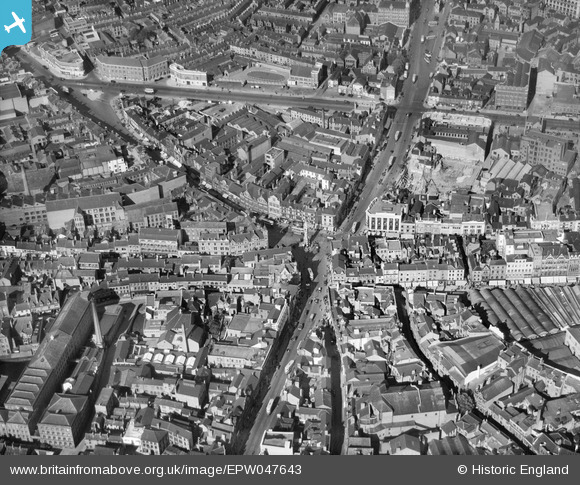
EPW047643 ENGLAND (1935). The Clock Tower and the city centre, Leicester, 1935
© Copyright OpenStreetMap contributors and licensed by the OpenStreetMap Foundation. 2024. Cartography is licensed as CC BY-SA.
Nearby Images (21)
EPW047643

EPW047641

EPW047645

EAW024243

EPW055006

EPW020895

EAW024242

EPW018433

EAW024239

EAW051834

EAW024244

EPW018422

EPW018412

EAW051831

EPW055011

EPW018435

EPW018431

EAW024240

EPW018436

EPW020892

EPW061211

Details
| Title | [EPW047643] The Clock Tower and the city centre, Leicester, 1935 |
| Reference | EPW047643 |
| Date | June-1935 |
| Link | |
| Place name | LEICESTER |
| Parish | |
| District | |
| Country | ENGLAND |
| Easting / Northing | 458778, 304638 |
| Longitude / Latitude | -1.1313547845948, 52.63595261703 |
| National Grid Reference | SK588046 |


