
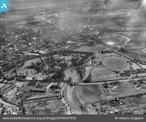
EPW047639 ENGLAND (1935). Abbey Park and environs, Leicester, from the north-east, 1935
© Copyright OpenStreetMap contributors and licensed by the OpenStreetMap Foundation. 2024. Cartography is licensed as CC BY-SA.
Nearby Images (14)
EPW047639

EAW043362

EAW010423

EAW010418

EAW010421

EPW047640

EPW055013

EAW010420

EAW010422

EAW010417

EAW010416

EAW024251
 and the site of Leicester Abbey, Leicester, 1949")
EAW010419

EAW024250
 and the site of Leicester Abbey, Leicester, 1949")
Details
| Title | [EPW047639] Abbey Park and environs, Leicester, from the north-east, 1935 |
| Reference | EPW047639 |
| Date | June-1935 |
| Link | |
| Place name | LEICESTER |
| Parish | |
| District | |
| Country | ENGLAND |
| Easting / Northing | 458691, 306122 |
| Longitude / Latitude | -1.1323763822607, 52.649302792258 |
| National Grid Reference | SK587061 |


