
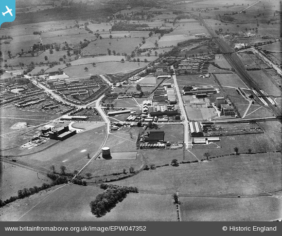
EPW047352 ENGLAND (1935). The Shredded Wheat Factory and other industrial works near Broadwater Road, Welwyn Garden City, 1935
© Copyright OpenStreetMap contributors and licensed by the OpenStreetMap Foundation. 2024. Cartography is licensed as CC BY-SA.
Nearby Images (19)
EPW047352

EPW047354

EPW054511

EPW054500

EPW062053

EPW054519

EPW022032

EPW054515

EPW054527

EPW054520

EPW014807

EPW054521

EAW053109

EPW014808

EPW022022

EPW054507

EPW054516

EAW016527
, Welwyn Garden City, 1948. This image has been produced from a damaged negative.")
EAW016528
, Welwyn Garden City, 1948. This image has been produced from a damaged negative.")
Details
| Title | [EPW047352] The Shredded Wheat Factory and other industrial works near Broadwater Road, Welwyn Garden City, 1935 |
| Reference | EPW047352 |
| Date | May-1935 |
| Link | |
| Place name | WELWYN GARDEN CITY |
| Parish | |
| District | |
| Country | ENGLAND |
| Easting / Northing | 524402, 212856 |
| Longitude / Latitude | -0.19567864056767, 51.800044665982 |
| National Grid Reference | TL244129 |
Pins
Be the first to add a comment to this image!
User Comment Contributions
 The Shredded Wheat Factory from a train, Welwyn Garden City, 10/06/2014 |
 Class31 |
Wednesday 11th of June 2014 04:45:52 PM |


