
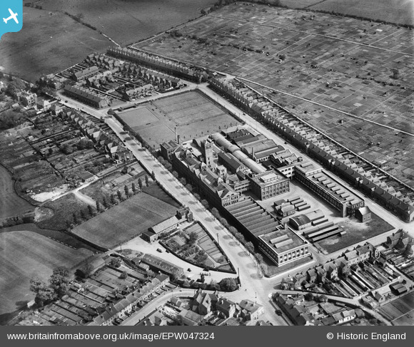
EPW047324 ENGLAND (1935). The Lotus Shoe Factory, Stafford, 1935
© Copyright OpenStreetMap contributors and licensed by the OpenStreetMap Foundation. 2024. Cartography is licensed as CC BY-SA.
Nearby Images (28)
EPW047324

EPW047319

EPW047668

EPW047666

EPW047321

EAW016407

EPW047323

EPW047325

EPW047664

EPW047326

EPW047663

EPW047320

EPW047322

EPW047667

EPW047669

EPW047670

EAW016406

EAW016402

EPW047665

EPW014118

EAW016403

EAW016405

EAW016404

EPW053372

EPW047336

EAW016398

EAW016401

EPW047335

Details
| Title | [EPW047324] The Lotus Shoe Factory, Stafford, 1935 |
| Reference | EPW047324 |
| Date | May-1935 |
| Link | |
| Place name | STAFFORD |
| Parish | |
| District | |
| Country | ENGLAND |
| Easting / Northing | 392523, 324403 |
| Longitude / Latitude | -2.1109551050411, 52.816784556544 |
| National Grid Reference | SJ925244 |
Pins
Be the first to add a comment to this image!


