
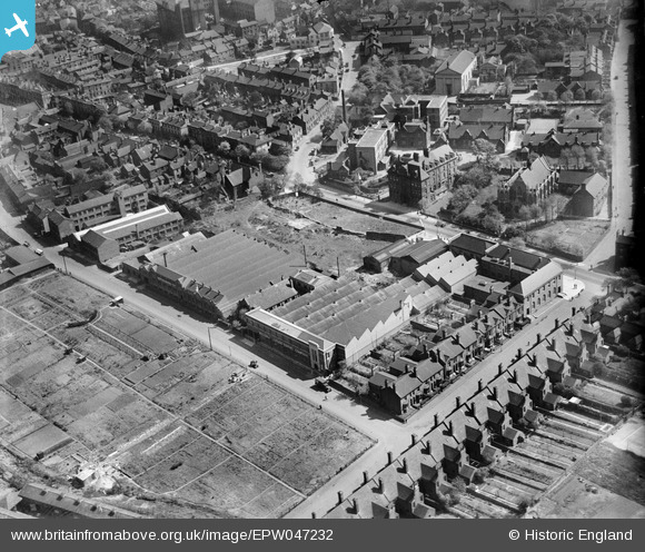
EPW047232 ENGLAND (1935). The Walsall Lithographic Company Works, Walsall, 1935
© Copyright OpenStreetMap contributors and licensed by the OpenStreetMap Foundation. 2024. Cartography is licensed as CC BY-SA.
Nearby Images (16)
EPW047232

EPW047234

EPW047233

EPW047226

EPW047227

EPW047231

EPW047228

EPW047229

EPW047230

EPW055785

EPW055783

EPW055782

EPW055776

EPW055781

EPW055786

EPW055784

Details
| Title | [EPW047232] The Walsall Lithographic Company Works, Walsall, 1935 |
| Reference | EPW047232 |
| Date | May-1935 |
| Link | |
| Place name | WALSALL |
| Parish | |
| District | |
| Country | ENGLAND |
| Easting / Northing | 401042, 298044 |
| Longitude / Latitude | -1.9846207203951, 52.579850201348 |
| National Grid Reference | SP010980 |
Pins
Be the first to add a comment to this image!


