
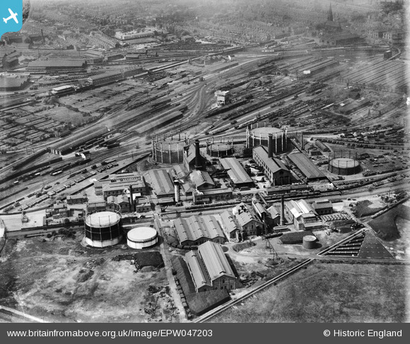
EPW047203 ENGLAND (1935). The Derby Gas Light and Coke Gas Works, Derby, 1935
© Copyright OpenStreetMap contributors and licensed by the OpenStreetMap Foundation. 2024. Cartography is licensed as CC BY-SA.
Nearby Images (16)
EPW047203

EAW002483

EPW047201

EPW017036

EAW002485

EPW047205

EPW017037

EPW047202

EPW047200

EPW047204

EAW002487

EAW002488

EAW002486

EAW002482

EPW047199

EAW002484

Details
| Title | [EPW047203] The Derby Gas Light and Coke Gas Works, Derby, 1935 |
| Reference | EPW047203 |
| Date | May-1935 |
| Link | |
| Place name | DERBY |
| Parish | |
| District | |
| Country | ENGLAND |
| Easting / Northing | 436829, 335056 |
| Longitude / Latitude | -1.4522835615699, 52.911348928041 |
| National Grid Reference | SK368351 |
Pins
 Peter Kazmierczak |
Thursday 12th of September 2013 10:23:08 PM | |
Peter Kazmierczak |
Thursday 12th of September 2013 10:22:22 PM |


