
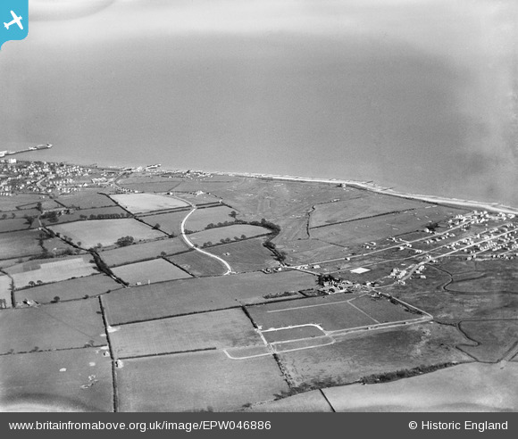
EPW046886 ENGLAND (1935). The Clacton-on-Sea Golf Course, West Road and the seafront, Clacton-on-Sea, 1935
© Copyright OpenStreetMap contributors and licensed by the OpenStreetMap Foundation. 2024. Cartography is licensed as CC BY-SA.
Nearby Images (10)
EPW046886

EPW046887

EPW046885

EPW046890

EPW046880

EPW046881

EPW046888

EPW046891

EPW046882

EPW046889

Details
| Title | [EPW046886] The Clacton-on-Sea Golf Course, West Road and the seafront, Clacton-on-Sea, 1935 |
| Reference | EPW046886 |
| Date | April-1935 |
| Link | |
| Place name | CLACTON-ON-SEA |
| Parish | |
| District | |
| Country | ENGLAND |
| Easting / Northing | 615871, 213731 |
| Longitude / Latitude | 1.1298451330837, 51.780084944286 |
| National Grid Reference | TM159137 |
Pins
Be the first to add a comment to this image!


