
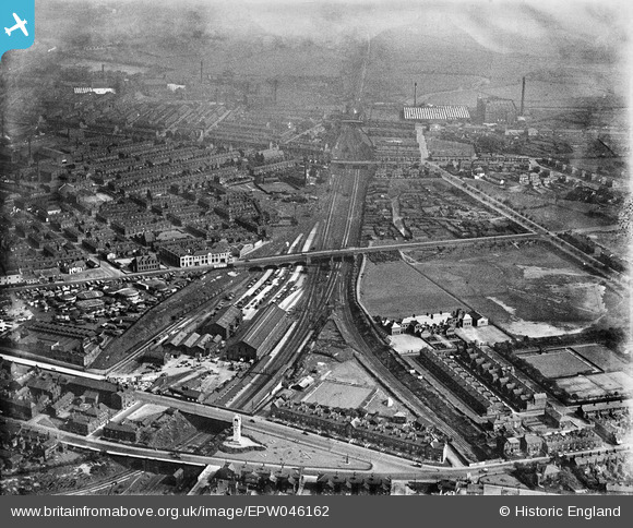
EPW046162 ENGLAND (1934). The Bury and Heywood Railway, the Whitehead Clock Tower and surrounding residential area, Bury, 1934
© Copyright OpenStreetMap contributors and licensed by the OpenStreetMap Foundation. 2024. Cartography is licensed as CC BY-SA.
Nearby Images (5)
EPW046162

EPW046166

EPW048659

EPW042021
, Bury, 1933")
EPW048661

Details
| Title | [EPW046162] The Bury and Heywood Railway, the Whitehead Clock Tower and surrounding residential area, Bury, 1934 |
| Reference | EPW046162 |
| Date | September-1934 |
| Link | |
| Place name | BURY |
| Parish | |
| District | |
| Country | ENGLAND |
| Easting / Northing | 380629, 410235 |
| Longitude / Latitude | -2.292664343459, 53.588100551455 |
| National Grid Reference | SD806102 |


