
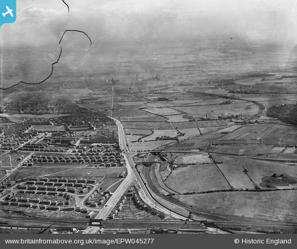
EPW045277 ENGLAND (1934). Residential area alongside Dewsbury Road and Beeston Park Side, Beeston, from the south-west, 1934. This image has been produced from a damaged negative.
© Copyright OpenStreetMap contributors and licensed by the OpenStreetMap Foundation. 2024. Cartography is licensed as CC BY-SA.
Nearby Images (3)
EPW045277

EPW045279

EPW045280

Details
| Title | [EPW045277] Residential area alongside Dewsbury Road and Beeston Park Side, Beeston, from the south-west, 1934. This image has been produced from a damaged negative. |
| Reference | EPW045277 |
| Date | July-1934 |
| Link | |
| Place name | BEESTON |
| Parish | |
| District | |
| Country | ENGLAND |
| Easting / Northing | 428776, 429666 |
| Longitude / Latitude | -1.563443044608, 53.762332701915 |
| National Grid Reference | SE288297 |
Pins
 trevpau |
Saturday 24th of December 2022 01:11:00 PM | |
John W |
Thursday 1st of December 2022 08:19:04 PM | |
trevorsboy |
Thursday 13th of October 2016 06:01:22 PM | |
trevorsboy |
Thursday 13th of October 2016 06:00:30 PM |


