
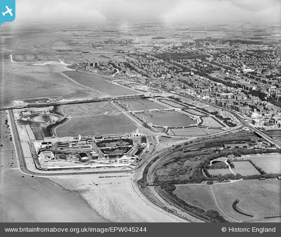
EPW045244 ENGLAND (1934). Princes Park and the seafront, Southport, from the south-west, 1934
© Copyright OpenStreetMap contributors and licensed by the OpenStreetMap Foundation. 2024. Cartography is licensed as CC BY-SA.
Nearby Images (14)
EPW045244

EPW058497

EPW045243

EPW045246

EPW020363

EPW020364

EAW010136

EPW020365

EPW013091

EPW018657

EAW038522

EAW010137

EAW038520

EAW010135

Details
| Title | [EPW045244] Princes Park and the seafront, Southport, from the south-west, 1934 |
| Reference | EPW045244 |
| Date | July-1934 |
| Link | |
| Place name | SOUTHPORT |
| Parish | |
| District | |
| Country | ENGLAND |
| Easting / Northing | 332779, 417280 |
| Longitude / Latitude | -3.0170405551076, 53.647468410327 |
| National Grid Reference | SD328173 |
Pins
 Andrew |
Thursday 13th of August 2015 09:38:25 PM | |
John Wass |
Saturday 9th of May 2015 02:15:12 PM | |
morris minor |
Thursday 7th of August 2014 08:50:06 PM | |
Bryan |
Thursday 8th of May 2014 08:44:43 PM | |
Bryan |
Thursday 8th of May 2014 08:43:07 PM | |
Bryan |
Thursday 8th of May 2014 08:42:28 PM | |
Bryan |
Thursday 8th of May 2014 08:41:12 PM |


