
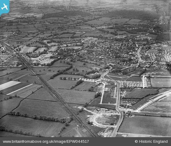
EPW044517 ENGLAND (1934). Housing under construction at The Roundways and West End Road and environs, Ruislip, 1934
© Copyright OpenStreetMap contributors and licensed by the OpenStreetMap Foundation. 2024. Cartography is licensed as CC BY-SA.
Nearby Images (4)
EPW044517

EPW044189

EPW001565

EPW044503

Details
| Title | [EPW044517] Housing under construction at The Roundways and West End Road and environs, Ruislip, 1934 |
| Reference | EPW044517 |
| Date | May-1934 |
| Link | |
| Place name | RUISLIP |
| Parish | |
| District | |
| Country | ENGLAND |
| Easting / Northing | 509250, 186759 |
| Longitude / Latitude | -0.42351642435175, 51.568630205491 |
| National Grid Reference | TQ093868 |
Pins
 The Laird |
Thursday 30th of April 2015 09:50:52 AM | |
The Laird |
Thursday 30th of April 2015 09:44:46 AM | |
The Laird |
Wednesday 29th of April 2015 03:47:27 PM | |
Steve Roberts |
Monday 20th of May 2013 02:49:33 PM |


