
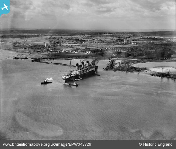
EPW043729 ENGLAND (1934). RMS Majestic entering the King George V Graving Dock, Southampton, 1934
© Copyright OpenStreetMap contributors and licensed by the OpenStreetMap Foundation. 2024. Cartography is licensed as CC BY-SA.
Nearby Images (19)
EPW043729

EPW043736

EPW043734

EPW042951

EPW043727

EPW043726

EPW043733

EPW043735

EPW043725

EPW043731

EPW043728

EAW001352

EAW004210

EPW043730

EAW004211

EAW205604

EPW043732

EAW001351

EAW035812

Details
| Title | [EPW043729] RMS Majestic entering the King George V Graving Dock, Southampton, 1934 |
| Reference | EPW043729 |
| Date | January-1934 |
| Link | |
| Place name | SOUTHAMPTON |
| Parish | |
| District | |
| Country | ENGLAND |
| Easting / Northing | 439415, 112174 |
| Longitude / Latitude | -1.4393522127779, 50.907137250357 |
| National Grid Reference | SU394122 |
Pins
Be the first to add a comment to this image!


