
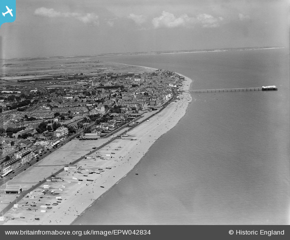
EPW042834 ENGLAND (1933). The town, Deal, from the south, 1933
© Copyright OpenStreetMap contributors and licensed by the OpenStreetMap Foundation. 2024. Cartography is licensed as CC BY-SA.
Nearby Images (2)
EPW042834

EPW035435

Details
| Title | [EPW042834] The town, Deal, from the south, 1933 |
| Reference | EPW042834 |
| Date | August-1933 |
| Link | |
| Place name | DEAL |
| Parish | WALMER |
| District | |
| Country | ENGLAND |
| Easting / Northing | 637853, 151737 |
| Longitude / Latitude | 1.4061848995876, 51.21469191462 |
| National Grid Reference | TR379517 |
Pins
 Alan McFaden |
Wednesday 9th of July 2014 10:06:20 AM | |
Alan McFaden |
Wednesday 9th of July 2014 10:05:42 AM | |
Alan McFaden |
Wednesday 9th of July 2014 10:04:34 AM | |
Alan McFaden |
Wednesday 9th of July 2014 10:02:27 AM |


