
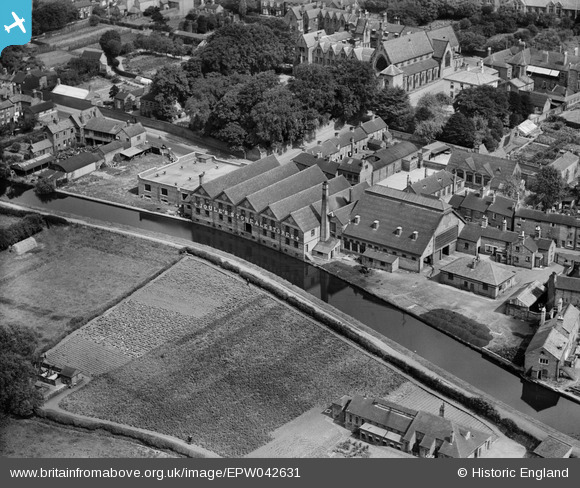
EPW042631 ENGLAND (1933). The Joule's Brewery Ale Stores, Stone, 1933
© Copyright OpenStreetMap contributors and licensed by the OpenStreetMap Foundation. 2024. Cartography is licensed as CC BY-SA.
Nearby Images (15)
EPW042631

EPW042630

EPW042632

EPW026979

EPW058407

EPW026985

EPW053351

EPW026984

EPW020073

EPW042627

EPW042628

EPW042629

EPW020072

EPW026981

EPW026982

Details
| Title | [EPW042631] The Joule's Brewery Ale Stores, Stone, 1933 |
| Reference | EPW042631 |
| Date | August-1933 |
| Link | |
| Place name | STONE |
| Parish | STONE |
| District | |
| Country | ENGLAND |
| Easting / Northing | 389933, 333962 |
| Longitude / Latitude | -2.1496847568907, 52.902681638569 |
| National Grid Reference | SJ899340 |
Pins
Be the first to add a comment to this image!


