
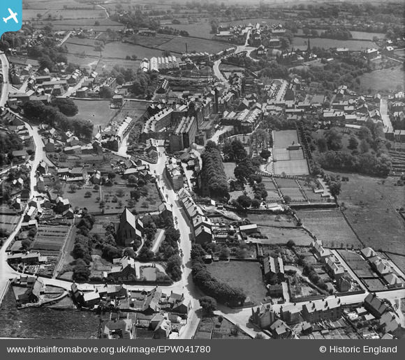
EPW041780 ENGLAND (1933). Matlock Bank, Matlock, 1933
© Copyright OpenStreetMap contributors and licensed by the OpenStreetMap Foundation. 2024. Cartography is licensed as CC BY-SA.
Nearby Images (7)
EPW041780

EPW038024

EPW041783

EPW005811

EPW053158

EPW005812

EPW038028

Details
| Title | [EPW041780] Matlock Bank, Matlock, 1933 |
| Reference | EPW041780 |
| Date | June-1933 |
| Link | |
| Place name | MATLOCK |
| Parish | MATLOCK TOWN |
| District | |
| Country | ENGLAND |
| Easting / Northing | 429900, 360748 |
| Longitude / Latitude | -1.5529452400456, 53.142747878175 |
| National Grid Reference | SK299607 |
Pins
Be the first to add a comment to this image!


