
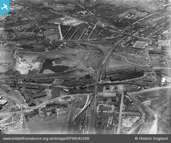
EPW041698 ENGLAND (1933). The Phoenix Special Steel Works, the Rother Iron Works and the town, Rotherham, 1933
© Copyright OpenStreetMap contributors and licensed by the OpenStreetMap Foundation. 2024. Cartography is licensed as CC BY-SA.
Nearby Images (11)
EPW041698

EAW029399

EPW041696

EPW048728

EPW041699

EAW030486

EAW025970

EAW030492

EPW041695

EAW029397

EPW041705

Details
| Title | [EPW041698] The Phoenix Special Steel Works, the Rother Iron Works and the town, Rotherham, 1933 |
| Reference | EPW041698 |
| Date | June-1933 |
| Link | |
| Place name | ROTHERHAM |
| Parish | |
| District | |
| Country | ENGLAND |
| Easting / Northing | 441715, 392136 |
| Longitude / Latitude | -1.3721791861312, 53.424108422311 |
| National Grid Reference | SK417921 |
Pins
 beaufighter |
Wednesday 20th of September 2017 11:23:04 AM | |
Holmes Junction |
Monday 24th of October 2016 06:20:00 PM | |
Holmes Junction |
Monday 24th of October 2016 06:17:35 PM | |
Peter Turvey |
Friday 24th of April 2015 07:06:01 PM | |
MandM |
Wednesday 12th of November 2014 08:25:33 PM | |
My money is on 'Holmes Lane'. |
Holmes Junction |
Monday 24th of October 2016 06:16:44 PM |
MandM |
Wednesday 12th of November 2014 08:24:20 PM | |
MandM |
Wednesday 12th of November 2014 08:23:41 PM | |
MandM |
Wednesday 12th of November 2014 08:22:29 PM | |
MandM |
Wednesday 12th of November 2014 08:21:28 PM | |
MandM |
Wednesday 12th of November 2014 08:20:27 PM |
User Comment Contributions
Rotherham United 'old' Football ground at Millmoor. |
MandM |
Wednesday 12th of November 2014 05:51:00 PM |


