
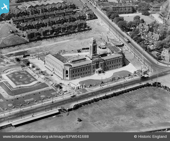
EPW041688 ENGLAND (1933). Trafford Town Hall (formerly Stretford Town Hall), Gorse Hill, 1933
© Copyright OpenStreetMap contributors and licensed by the OpenStreetMap Foundation. 2024. Cartography is licensed as CC BY-SA.
Nearby Images (12)
EPW041688
, Gorse Hill, 1933")
EPW045986

EPW038538

EPW045988

EAW006504

EPR000191

EPW038540

EAW006246
, 1947")
EPW041683

EAW006503

EPW038537

EPW045985

Details
| Title | [EPW041688] Trafford Town Hall (formerly Stretford Town Hall), Gorse Hill, 1933 |
| Reference | EPW041688 |
| Date | June-1933 |
| Link | |
| Place name | GORSE HILL |
| Parish | |
| District | |
| Country | ENGLAND |
| Easting / Northing | 381009, 395771 |
| Longitude / Latitude | -2.286045986637, 53.458093013062 |
| National Grid Reference | SJ810958 |
Pins
Be the first to add a comment to this image!
User Comment Contributions
Stretford, previously an Urban District, became a Municipal Borough in 1933. Trafford was invented as an administrative district in 1974. So it's Stretford Town Hall. |
 Dylan Moore |
Monday 6th of May 2013 11:41:34 AM |


