
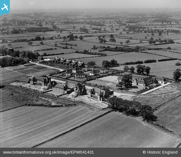
EPW041431 ENGLAND (1933). Derbyshire County Council Mental Hospital, Edmund's Square and environs, Burnaston, from the south-east, 1933
© Copyright OpenStreetMap contributors and licensed by the OpenStreetMap Foundation. 2024. Cartography is licensed as CC BY-SA.
Nearby Images (3)
EPW041431

EPW041430

EPW041434
 and surrounding countryside, Burnaston, 1933")
Details
| Title | [EPW041431] Derbyshire County Council Mental Hospital, Edmund's Square and environs, Burnaston, from the south-east, 1933 |
| Reference | EPW041431 |
| Date | June-1933 |
| Link | |
| Place name | BURNASTON |
| Parish | BURNASTON |
| District | |
| Country | ENGLAND |
| Easting / Northing | 430066, 333363 |
| Longitude / Latitude | -1.5530150335196, 52.896549784891 |
| National Grid Reference | SK301334 |
Pins
Be the first to add a comment to this image!


