
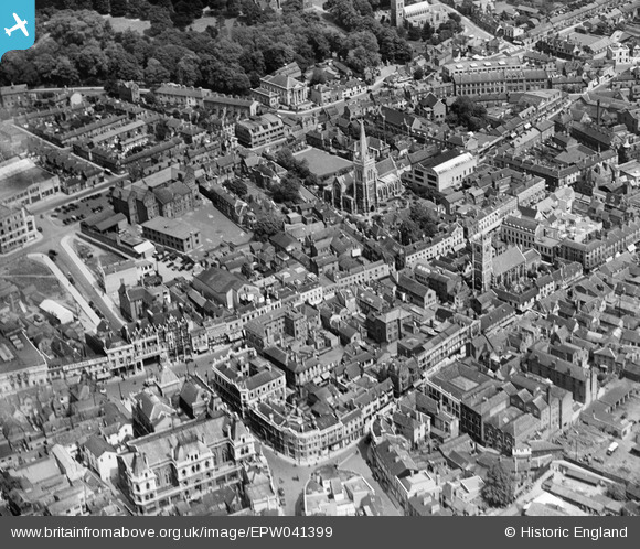
EPW041399 ENGLAND (1933). Tavern Street and environs, Ipswich, 1933
© Copyright OpenStreetMap contributors and licensed by the OpenStreetMap Foundation. 2024. Cartography is licensed as CC BY-SA.
Nearby Images (11)
EPW041399

EPW001834

EPW005298A

EPW005255

EPW005249

EPW058744

EPW001824

EPW032875

EPW001835

EPW001831

EAW024671

Details
| Title | [EPW041399] Tavern Street and environs, Ipswich, 1933 |
| Reference | EPW041399 |
| Date | May-1933 |
| Link | |
| Place name | IPSWICH |
| Parish | |
| District | |
| Country | ENGLAND |
| Easting / Northing | 616336, 244646 |
| Longitude / Latitude | 1.1559979643449, 52.057469479837 |
| National Grid Reference | TM163446 |


