
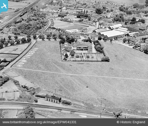
EPW041331 ENGLAND (1933). Huntingdon County Hospital, Huntingdon, 1933
© Copyright OpenStreetMap contributors and licensed by the OpenStreetMap Foundation. 2024. Cartography is licensed as CC BY-SA.
Nearby Images (10)
EPW041331

EPW009842

EPW041302

EPW041297

EPW041300

EPW041301

EPW041303

EPW041304

EPW041298

EPW041299

Details
| Title | [EPW041331] Huntingdon County Hospital, Huntingdon, 1933 |
| Reference | EPW041331 |
| Date | May-1933 |
| Link | |
| Place name | HUNTINGDON |
| Parish | HUNTINGDON |
| District | |
| Country | ENGLAND |
| Easting / Northing | 523467, 271643 |
| Longitude / Latitude | -0.18796913353989, 52.328582109853 |
| National Grid Reference | TL235716 |
Pins
 MB |
Monday 6th of October 2014 10:46:17 PM | |
 Class31 |
Wednesday 10th of September 2014 08:03:05 AM | |
You can hardly see the cannon. I thought that I had dreamt of it but I found it when I looked closely! |
Class31 |
Wednesday 10th of September 2014 08:09:53 AM |
Class31 |
Wednesday 10th of September 2014 08:00:18 AM | |
John Wass |
Tuesday 9th of September 2014 03:46:12 PM | |
Amadis |
Sunday 22nd of December 2013 09:32:20 PM | |
Amadis |
Sunday 22nd of December 2013 09:31:41 PM |


User Comment Contributions
 Huntingdon County Hospital , 10/06/2014 |
Class31 |
Wednesday 10th of September 2014 08:15:16 AM |


