
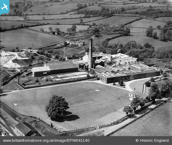
EPW041140 ENGLAND (1933). St Cuthbert's Paper Mill, Wookey Hole, 1933
© Copyright OpenStreetMap contributors and licensed by the OpenStreetMap Foundation. 2024. Cartography is licensed as CC BY-SA.
Nearby Images (15)
EPW041140

EPW009593

EPW009598

EPW009595

EPW041142

EPW041141

EPW009596

EPW009590

EPW009591

EPR000104

EPW009594

EPW009597

EPR000105

EPW009592

EPW041143

Details
| Title | [EPW041140] St Cuthbert's Paper Mill, Wookey Hole, 1933 |
| Reference | EPW041140 |
| Date | May-1933 |
| Link | |
| Place name | WOOKEY HOLE |
| Parish | ST. CUTHBERT OUT |
| District | |
| Country | ENGLAND |
| Easting / Northing | 353035, 146536 |
| Longitude / Latitude | -2.6724955451536, 51.215574784994 |
| National Grid Reference | ST530465 |
Pins
 MB |
Sunday 11th of August 2013 11:21:46 PM |


