
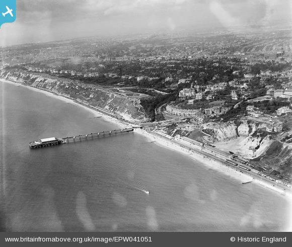
EPW041051 ENGLAND (1933). The pier and the town, Boscombe, from the south-east, 1933
© Copyright OpenStreetMap contributors and licensed by the OpenStreetMap Foundation. 2024. Cartography is licensed as CC BY-SA.
Nearby Images (12)
EPW041051

EPW037435

EPW037436

EAW035606

EAW049058

EPR000669

EPR000287

EPR000665

EPW013550

EAW035604

EPW013565

EPW018169

Details
| Title | [EPW041051] The pier and the town, Boscombe, from the south-east, 1933 |
| Reference | EPW041051 |
| Date | April-1933 |
| Link | |
| Place name | BOSCOMBE |
| Parish | |
| District | |
| Country | ENGLAND |
| Easting / Northing | 411294, 91022 |
| Longitude / Latitude | -1.8399990823262, 50.71814163831 |
| National Grid Reference | SZ113910 |
Pins
Be the first to add a comment to this image!


