
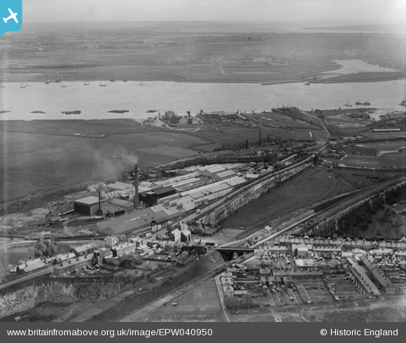
EPW040950 ENGLAND (1933). The British Vegetable Parchment Mills, the New Northfleet Paper Mills and the River Thames, Swanscombe, 1933
© Copyright OpenStreetMap contributors and licensed by the OpenStreetMap Foundation. 2024. Cartography is licensed as CC BY-SA.
Nearby Images (25)
EPW040950

EPW040722

EPW018632

EPW028501

EPW040719

EPW040718

EAW050793

EPW028502

EAW050802

EAW050799

EAW050801

EAW050798

EAW050797

EAW050800

EPW040948

EPW028504

EPW028503

EPW040947

EPW040951

EPW028506

EPW040720

EPW028498

EAW050796

EPW028505

EPW040725

Details
| Title | [EPW040950] The British Vegetable Parchment Mills, the New Northfleet Paper Mills and the River Thames, Swanscombe, 1933 |
| Reference | EPW040950 |
| Date | April-1933 |
| Link | |
| Place name | SWANSCOMBE |
| Parish | SWANSCOMBE AND GREENHITHE |
| District | |
| Country | ENGLAND |
| Easting / Northing | 560618, 174831 |
| Longitude / Latitude | 0.31174641980067, 51.449163333958 |
| National Grid Reference | TQ606748 |
Pins
Be the first to add a comment to this image!


