
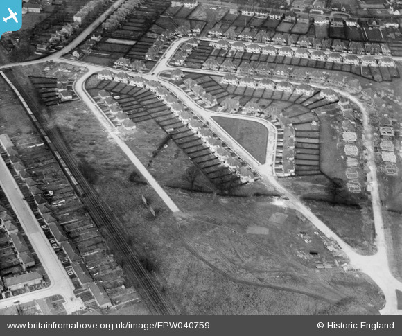
EPW040759 ENGLAND (1932). A new housing estate under construction, Norbiton, 1932
© Copyright OpenStreetMap contributors and licensed by the OpenStreetMap Foundation. 2024. Cartography is licensed as CC BY-SA.
Nearby Images (6)
EPW040759

EPW040755

EPW040754

EPW040758

EPW040756

EPW040757

Details
| Title | [EPW040759] A new housing estate under construction, Norbiton, 1932 |
| Reference | EPW040759 |
| Date | October-1932 |
| Link | |
| Place name | NORBITON |
| Parish | |
| District | |
| Country | ENGLAND |
| Easting / Northing | 519901, 169255 |
| Longitude / Latitude | -0.2758400776758, 51.409131977141 |
| National Grid Reference | TQ199693 |
Pins
 totoro |
Wednesday 19th of February 2014 03:01:53 PM | |
totoro |
Wednesday 19th of February 2014 02:57:49 PM | |
totoro |
Wednesday 19th of February 2014 02:57:25 PM | |
totoro |
Wednesday 19th of February 2014 02:56:12 PM | |
totoro |
Wednesday 19th of February 2014 02:54:33 PM | |
totoro |
Wednesday 19th of February 2014 02:54:17 PM | |
totoro |
Wednesday 19th of February 2014 02:54:02 PM |


