
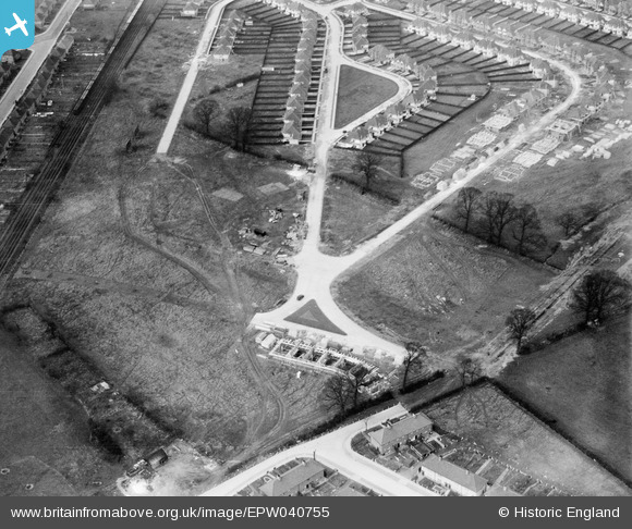
EPW040755 ENGLAND (1932). A new housing estate under construction, Norbiton, 1932
© Copyright OpenStreetMap contributors and licensed by the OpenStreetMap Foundation. 2024. Cartography is licensed as CC BY-SA.
Nearby Images (4)
EPW040755

EPW040754

EPW040757

EPW040759

Details
| Title | [EPW040755] A new housing estate under construction, Norbiton, 1932 |
| Reference | EPW040755 |
| Date | October-1932 |
| Link | |
| Place name | NORBITON |
| Parish | |
| District | |
| Country | ENGLAND |
| Easting / Northing | 520044, 169172 |
| Longitude / Latitude | -0.2738128598674, 51.408355666584 |
| National Grid Reference | TQ200692 |
Pins
Be the first to add a comment to this image!
User Comment Contributions
This is 'The Triangle' and Arundel Road, KT1. |
 C Osborne |
Monday 20th of March 2017 03:39:12 AM |


