
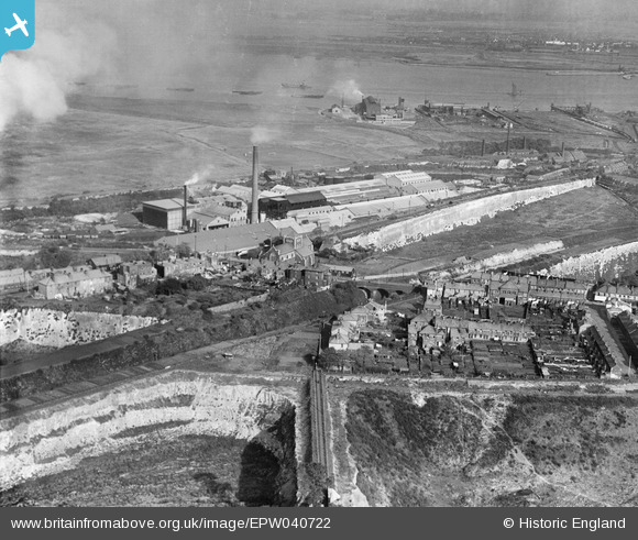
EPW040722 ENGLAND (1932). All Saints' Church and environs, Swanscombe, 1932
© Copyright OpenStreetMap contributors and licensed by the OpenStreetMap Foundation. 2024. Cartography is licensed as CC BY-SA.
Nearby Images (24)
EPW040722

EPW040950

EPW028501

EPW040719

EPW018632

EPW040718

EAW050793

EPW028502

EPW028504

EAW050802

EAW050799

EAW050801

EAW050797

EAW050800

EAW050798

EPW040948

EPW028503

EPW028505

EPW028506

EPW040951

EPW040947

EPW040720

EPW028498

EAW050796

Details
| Title | [EPW040722] All Saints' Church and environs, Swanscombe, 1932 |
| Reference | EPW040722 |
| Date | October-1932 |
| Link | |
| Place name | SWANSCOMBE |
| Parish | SWANSCOMBE AND GREENHITHE |
| District | |
| Country | ENGLAND |
| Easting / Northing | 560589, 174834 |
| Longitude / Latitude | 0.31133075481347, 51.449198515599 |
| National Grid Reference | TQ606748 |
Pins
 Dylan Moore |
Monday 22nd of September 2014 10:23:48 PM |


