
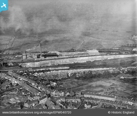
EPW040720 ENGLAND (1932). The High Street and paper mills beside Galley Hill Road, Swanscombe, 1932
© Copyright OpenStreetMap contributors and licensed by the OpenStreetMap Foundation. 2024. Cartography is licensed as CC BY-SA.
Nearby Images (28)
EPW040720

EPW040947

EPW040951

EPW018631

EPW018630

EAW050798

EPW040725

EAW050799

EAW050801

EAW050796

EPW040948

EAW050800

EAW050802

EPW028498

EPW028506

EAW050797

EPW028502

EPW040724

EAW050793

EPW040949

EPW040732

EPW028503

EPW040721

EPW018633

EPW040718

EPW018632

EPW040950

EPW040722

Details
| Title | [EPW040720] The High Street and paper mills beside Galley Hill Road, Swanscombe, 1932 |
| Reference | EPW040720 |
| Date | October-1932 |
| Link | |
| Place name | SWANSCOMBE |
| Parish | SWANSCOMBE AND GREENHITHE |
| District | |
| Country | ENGLAND |
| Easting / Northing | 560828, 174969 |
| Longitude / Latitude | 0.31482899889934, 51.450343686156 |
| National Grid Reference | TQ608750 |
Pins
Be the first to add a comment to this image!


