
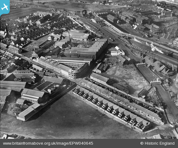
EPW040645 ENGLAND (1932). The Sunderland Forge and Engineering Co Ltd Works, Sunderland, 1932
© Copyright OpenStreetMap contributors and licensed by the OpenStreetMap Foundation. 2024. Cartography is licensed as CC BY-SA.
Nearby Images (7)
EPW040645

EPW040644

EPW040642

EPW040643

EPW040646

EPW040647

EPW054627

Details
| Title | [EPW040645] The Sunderland Forge and Engineering Co Ltd Works, Sunderland, 1932 |
| Reference | EPW040645 |
| Date | October-1932 |
| Link | |
| Place name | SUNDERLAND |
| Parish | |
| District | |
| Country | ENGLAND |
| Easting / Northing | 437947, 557381 |
| Longitude / Latitude | -1.4080554348597, 54.909614762239 |
| National Grid Reference | NZ379574 |
Pins
 Porcy |
Thursday 11th of October 2018 11:18:22 PM | |
kevin n |
Friday 29th of November 2013 11:31:16 AM | |
MalcolmGH |
Thursday 9th of May 2013 08:54:30 AM | |
Served some of my Apprenticeship at Lynn's before it closed. Then was transferred to the Sunderland Forge where I worked until the early 1970'S. |
Peter Harrison |
Sunday 26th of January 2014 12:35:42 PM |
User Comment Contributions
I wondered what the building's were just to the right of the main Sunderland to Durham line on the right hand side of the picture. Unusual shaped roofs, with chimneys at frequest intervals? |
MalcolmGH |
Thursday 9th of May 2013 08:56:27 AM |


