
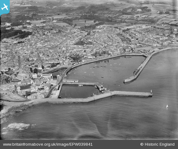
EPW039841 ENGLAND (1932). The harbour and the town, Penzance, 1932
© Copyright OpenStreetMap contributors and licensed by the OpenStreetMap Foundation. 2024. Cartography is licensed as CC BY-SA.
Nearby Images (4)
EPW039841

EAW280180

EPW059667

EAW033634

Details
| Title | [EPW039841] The harbour and the town, Penzance, 1932 |
| Reference | EPW039841 |
| Date | August-1932 |
| Link | |
| Place name | PENZANCE |
| Parish | PENZANCE |
| District | |
| Country | ENGLAND |
| Easting / Northing | 147630, 30244 |
| Longitude / Latitude | -5.5307961965977, 50.117903515196 |
| National Grid Reference | SW476302 |
Pins
 Ritchiet |
Friday 29th of April 2022 11:07:51 PM | |
Ritchiet |
Friday 29th of April 2022 10:59:45 PM | |
Ritchiet |
Friday 29th of April 2022 10:54:29 PM | |
Ritchiet |
Friday 29th of April 2022 10:48:40 PM | |
Ritchiet |
Friday 29th of April 2022 10:45:45 PM | |
.JPG) Colin1949 |
Wednesday 5th of March 2014 05:05:18 PM |

User Comment Contributions
Are you sure about the date? |
dingdongd |
Friday 3rd of May 2013 09:39:19 PM |


