
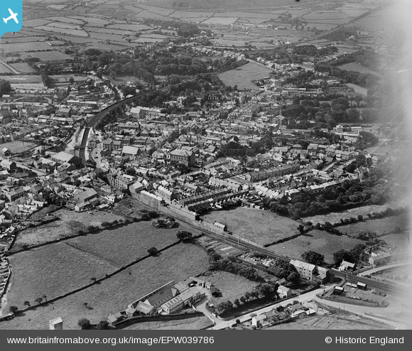
EPW039786 ENGLAND (1932). The town, Redruth, 1932
© Copyright OpenStreetMap contributors and licensed by the OpenStreetMap Foundation. 2024. Cartography is licensed as CC BY-SA.
Nearby Images (11)
EPW039786

EPW021730

EPW021732

EPW021731

EPW009904A

EPW039789

EPW009902

EPW009905

EPW021734

EPW039787

EAW033647

Details
| Title | [EPW039786] The town, Redruth, 1932 |
| Reference | EPW039786 |
| Date | August-1932 |
| Link | |
| Place name | REDRUTH |
| Parish | REDRUTH |
| District | |
| Country | ENGLAND |
| Easting / Northing | 170017, 42187 |
| Longitude / Latitude | -5.2253598748005, 50.234251253532 |
| National Grid Reference | SW700422 |
Pins
 Pentaprism |
Saturday 31st of October 2020 02:10:16 AM | |
abstejam |
Wednesday 14th of May 2014 07:56:38 PM | |
abstejam |
Wednesday 14th of May 2014 07:56:34 PM |


