
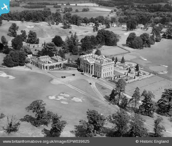
EPW039625 ENGLAND (1932). Moor Park House and Golf Course, Moor Park, 1932
© Copyright OpenStreetMap contributors and licensed by the OpenStreetMap Foundation. 2024. Cartography is licensed as CC BY-SA.
Nearby Images (14)
EPW039625

EPW020990

EPW059095

EAW021539

EPW020991

EPW039624

EAW021538

EAW015433

EAW046076

EAW046074

EAW004292

EPW015338
, Moor Park, 1926")
EAW046075

EAW046077

Details
| Title | [EPW039625] Moor Park House and Golf Course, Moor Park, 1932 |
| Reference | EPW039625 |
| Date | August-1932 |
| Link | |
| Place name | MOOR PARK |
| Parish | |
| District | |
| Country | ENGLAND |
| Easting / Northing | 507511, 193289 |
| Longitude / Latitude | -0.44659853068136, 51.62766304898 |
| National Grid Reference | TQ075933 |
Pins
Be the first to add a comment to this image!


