
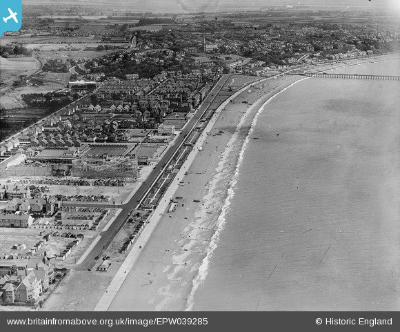
EPW039285 ENGLAND (1932). Sea Road and the town, Felixstowe, from the south-west, 1932
© Copyright OpenStreetMap contributors and licensed by the OpenStreetMap Foundation. 2024. Cartography is licensed as CC BY-SA.
Nearby Images (5)
EPW039285

EAW024309

EAW048299

EPW002005

EAW048294

Details
| Title | [EPW039285] Sea Road and the town, Felixstowe, from the south-west, 1932 |
| Reference | EPW039285 |
| Date | July-1932 |
| Link | |
| Place name | FELIXSTOWE |
| Parish | FELIXSTOWE |
| District | |
| Country | ENGLAND |
| Easting / Northing | 629511, 233349 |
| Longitude / Latitude | 1.340290262946, 51.950763469915 |
| National Grid Reference | TM295333 |


