
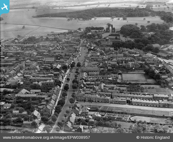
EPW038957 ENGLAND (1932). Westgate, Guisborough, 1932
© Copyright OpenStreetMap contributors and licensed by the OpenStreetMap Foundation. 2024. Cartography is licensed as CC BY-SA.
Nearby Images (4)
EPW038957

EPW038956

EPW038958

EPW029094

Details
| Title | [EPW038957] Westgate, Guisborough, 1932 |
| Reference | EPW038957 |
| Date | July-1932 |
| Link | |
| Place name | GUISBOROUGH |
| Parish | GUISBOROUGH |
| District | |
| Country | ENGLAND |
| Easting / Northing | 461345, 515955 |
| Longitude / Latitude | -1.0518391643073, 54.535018990046 |
| National Grid Reference | NZ613160 |
Pins
Be the first to add a comment to this image!
User Comment Contributions
 Westgate, Guisborough, 1932 |
 Ali |
Sunday 20th of January 2013 09:11:43 PM |


