
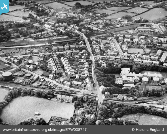
EPW038747 ENGLAND (1932). Breck Road and environs, Poulton-Le-Fylde, 1932. This image has been produced from a copy-negative.
© Copyright OpenStreetMap contributors and licensed by the OpenStreetMap Foundation. 2024. Cartography is licensed as CC BY-SA.
Nearby Images (3)
EPW038747

EPW038748

EPW038749

Details
| Title | [EPW038747] Breck Road and environs, Poulton-Le-Fylde, 1932. This image has been produced from a copy-negative. |
| Reference | EPW038747 |
| Date | June-1932 |
| Link | |
| Place name | POULTON-LE-FYLDE |
| Parish | |
| District | |
| Country | ENGLAND |
| Easting / Northing | 335008, 439739 |
| Longitude / Latitude | -2.9880469782829, 53.849606111546 |
| National Grid Reference | SD350397 |
Pins
Be the first to add a comment to this image!


