
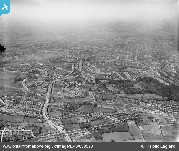
EPW038523 ENGLAND (1932). New housing estates surrounding Clent Road, Warley Hall Road and Warley Park, Warley Woods, from the south, 1932
© Copyright OpenStreetMap contributors and licensed by the OpenStreetMap Foundation. 2024. Cartography is licensed as CC BY-SA.
Nearby Images (2)
EPW038523

EPW038521

Details
| Title | [EPW038523] New housing estates surrounding Clent Road, Warley Hall Road and Warley Park, Warley Woods, from the south, 1932 |
| Reference | EPW038523 |
| Date | June-1932 |
| Link | |
| Place name | WARLEY WOODS |
| Parish | |
| District | |
| Country | ENGLAND |
| Easting / Northing | 400744, 285646 |
| Longitude / Latitude | -1.9890467788353, 52.468381013021 |
| National Grid Reference | SP007856 |
Pins
 KevinMc |
Saturday 30th of September 2017 02:01:07 PM | |
Steve Cemm |
Wednesday 3rd of August 2016 08:25:50 PM | |
MathewSmart |
Friday 14th of November 2014 12:07:08 AM | |
Stormy78 |
Wednesday 23rd of July 2014 05:25:51 PM | |
Stormy78 |
Wednesday 23rd of July 2014 05:24:50 PM | |
Stormy78 |
Wednesday 23rd of July 2014 05:23:22 PM | |
Stormy78 |
Wednesday 23rd of July 2014 05:21:21 PM | |
Stormy78 |
Wednesday 23rd of July 2014 05:20:08 PM | |
artscotak2 |
Friday 3rd of May 2013 06:11:38 PM | |
Steve Cemm |
Friday 4th of January 2013 06:05:13 PM | |
Steve Cemm |
Friday 4th of January 2013 06:04:33 PM | |
Steve Cemm |
Friday 4th of January 2013 06:03:42 PM |


