
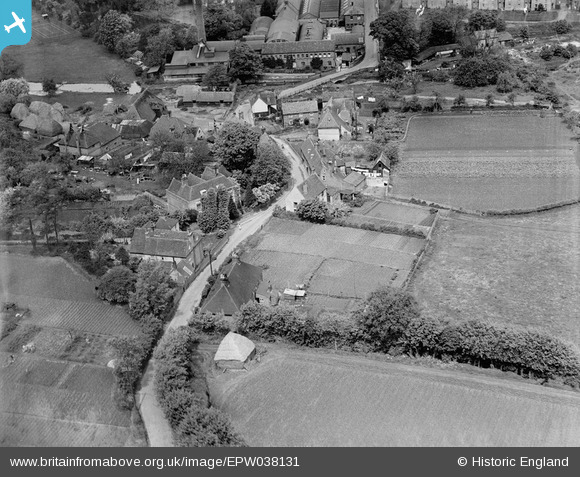
EPW038131 ENGLAND (1932). Rattington Street, Chartham, 1932
© Copyright OpenStreetMap contributors and licensed by the OpenStreetMap Foundation. 2024. Cartography is licensed as CC BY-SA.
Nearby Images (21)
EPW038131

EAW026263

EAW026259

EAW026257

EAW026260

EAW026262

EAW026258

EAW014327

EAW026261

EAW026264

EAW014331

EAW026256

EAW014325

EAW014330

EAW014329

EAW014328

EAW014332

EAW014333

EAW014326

EAW004715

EAW004718

Details
| Title | [EPW038131] Rattington Street, Chartham, 1932 |
| Reference | EPW038131 |
| Date | May-1932 |
| Link | |
| Place name | CHARTHAM |
| Parish | CHARTHAM |
| District | |
| Country | ENGLAND |
| Easting / Northing | 610924, 154846 |
| Longitude / Latitude | 1.022989464165, 51.253195290787 |
| National Grid Reference | TR109548 |
Pins
 Kentishman |
Monday 18th of July 2016 03:57:53 PM | |
Kentishman |
Monday 18th of July 2016 03:47:43 PM | |
Kentishman |
Monday 18th of July 2016 03:30:34 PM |


