
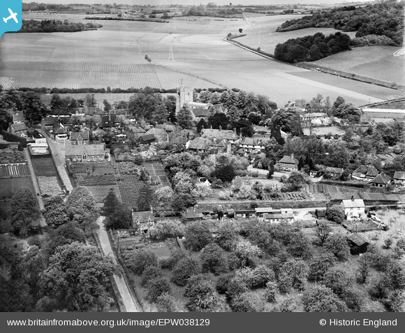
EPW038129 ENGLAND (1932). The village, Chilham, 1932
© Copyright OpenStreetMap contributors and licensed by the OpenStreetMap Foundation. 2024. Cartography is licensed as CC BY-SA.
Nearby Images (16)
EPW038129

EPW038130

EPW038128

EAW004708

EAW004710

EAW004707

EAW004706

EAW004713

EAW042665

EAW004709

EAW004711

EAW042663

EAW004712

EAW042664

EAW013912

EAW042666

Details
| Title | [EPW038129] The village, Chilham, 1932 |
| Reference | EPW038129 |
| Date | May-1932 |
| Link | |
| Place name | CHILHAM |
| Parish | CHILHAM |
| District | |
| Country | ENGLAND |
| Easting / Northing | 606926, 153571 |
| Longitude / Latitude | 0.96503565600516, 51.243209538335 |
| National Grid Reference | TR069536 |
Pins
Be the first to add a comment to this image!


