
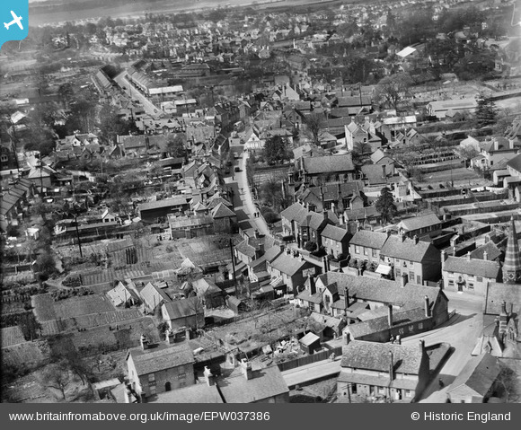
EPW037386 ENGLAND (1932). The High Street and the town centre, Rickmansworth, 1932
© Copyright OpenStreetMap contributors and licensed by the OpenStreetMap Foundation. 2024. Cartography is licensed as CC BY-SA.
Nearby Images (5)
EPW037386

EPW056338

EAW029476

EPW019276

EAW026495

Details
| Title | [EPW037386] The High Street and the town centre, Rickmansworth, 1932 |
| Reference | EPW037386 |
| Date | April-1932 |
| Link | |
| Place name | RICKMANSWORTH |
| Parish | |
| District | |
| Country | ENGLAND |
| Easting / Northing | 506141, 194463 |
| Longitude / Latitude | -0.46602963340321, 51.638476384938 |
| National Grid Reference | TQ061945 |
Pins
 The Laird |
Thursday 30th of April 2015 11:33:18 AM | |
ian |
Sunday 16th of December 2012 10:19:32 PM | |
ian |
Sunday 16th of December 2012 10:17:24 PM | |
ian |
Sunday 16th of December 2012 10:16:56 PM | |
ian |
Sunday 16th of December 2012 10:15:48 PM | |
Now the home of Three Rivers Museum Trust http://trmt.org.uk/ |
LesMead |
Tuesday 7th of May 2013 12:05:28 PM |
ian |
Sunday 16th of December 2012 10:15:22 PM | |
ian |
Sunday 16th of December 2012 10:14:39 PM |


