
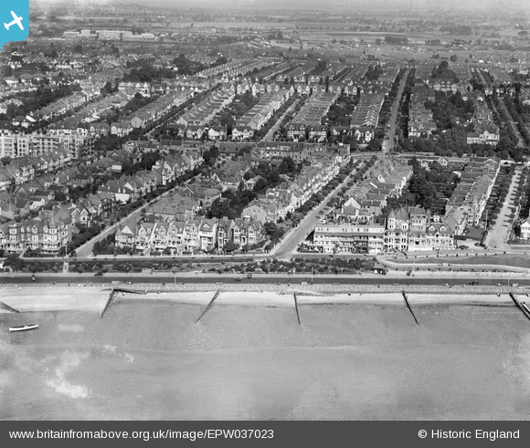
EPW037023 ENGLAND (1931). The Western Esplanade, Palmerston Road and environs, Westcliff-on-Sea, 1931
© Copyright OpenStreetMap contributors and licensed by the OpenStreetMap Foundation. 2024. Cartography is licensed as CC BY-SA.
Nearby Images (18)
EPW037023

EPW036732

EAW053092

EPW000543

EPW037025

EPW024884

EPW037022

EAW053103

EPW054668

EPW040969

EAW043707

EPW024876

EPW037019

EPW037021

EPW040985

EAW043706

EPW058502

EPW054674

Details
| Title | [EPW037023] The Western Esplanade, Palmerston Road and environs, Westcliff-on-Sea, 1931 |
| Reference | EPW037023 |
| Date | October-1931 |
| Link | |
| Place name | WESTCLIFF-ON-SEA |
| Parish | |
| District | |
| Country | ENGLAND |
| Easting / Northing | 586511, 185339 |
| Longitude / Latitude | 0.68956259268216, 51.535616943662 |
| National Grid Reference | TQ865853 |
Pins
Be the first to add a comment to this image!


