
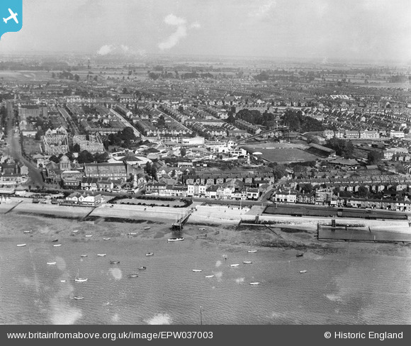
EPW037003 ENGLAND (1931). The Kursaal and environs, Southend-on-Sea, from the south, 1931
© Copyright OpenStreetMap contributors and licensed by the OpenStreetMap Foundation. 2024. Cartography is licensed as CC BY-SA.
Nearby Images (23)
EPW037003

EPW037004

EAW024660

EPW024887

EPW040962

EPW040961

EAW053086

EPW036995

EPW000444

EPW058226

EPW036726

EAW002219

EPW062745

EPW036730

EPW058224

EPW036736

EPW058222

EPW000443

EPW040987

EPW036613

EAW002193

EPW040965

EPW024890

Details
| Title | [EPW037003] The Kursaal and environs, Southend-on-Sea, from the south, 1931 |
| Reference | EPW037003 |
| Date | October-1931 |
| Link | |
| Place name | SOUTHEND-ON-SEA |
| Parish | |
| District | |
| Country | ENGLAND |
| Easting / Northing | 589161, 184886 |
| Longitude / Latitude | 0.72748701656141, 51.530666223713 |
| National Grid Reference | TQ892849 |
Pins
Be the first to add a comment to this image!


