
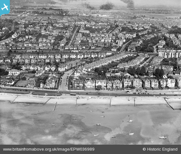
EPW036989 ENGLAND (1931). Crowstone Avenue and environs, Southend-on-Sea, from the south-west, 1931
© Copyright OpenStreetMap contributors and licensed by the OpenStreetMap Foundation. 2024. Cartography is licensed as CC BY-SA.
Nearby Images (12)
EPW036989

EPW037002

EPW040970

EPW037018

EPW032902

EPW036711

EPW036716

EPW024867

EPW054674

EPW054673

EAW043704

EAW043705

Details
| Title | [EPW036989] Crowstone Avenue and environs, Southend-on-Sea, from the south-west, 1931 |
| Reference | EPW036989 |
| Date | October-1931 |
| Link | |
| Place name | SOUTHEND-ON-SEA |
| Parish | |
| District | |
| Country | ENGLAND |
| Easting / Northing | 586054, 185259 |
| Longitude / Latitude | 0.68293797612678, 51.535049144125 |
| National Grid Reference | TQ861853 |
Pins
Be the first to add a comment to this image!


