
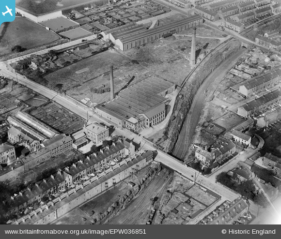
EPW036851 ENGLAND (1931). The Kingston Confectionery Works on Hopwood Lane, Halifax, 1931
© Copyright OpenStreetMap contributors and licensed by the OpenStreetMap Foundation. 2024. Cartography is licensed as CC BY-SA.
Nearby Images (23)
EPW036851

EPW036856

EPW036850

EPW036855

EPW036854

EPW036852

EPW036853

EAW004555

EAW028038

EAW004551

EAW028035

EAW028041

EAW028030

EAW028031

EAW028039

EAW004552

EAW028034

EAW028040

EAW004557

EAW004554

EAW004553

EAW004556

EAW004558

Details
| Title | [EPW036851] The Kingston Confectionery Works on Hopwood Lane, Halifax, 1931 |
| Reference | EPW036851 |
| Date | September-1931 |
| Link | |
| Place name | HALIFAX |
| Parish | |
| District | |
| Country | ENGLAND |
| Easting / Northing | 407761, 424917 |
| Longitude / Latitude | -1.8823764000156, 53.720380589931 |
| National Grid Reference | SE078249 |
Pins
 RT |
Monday 12th of March 2018 02:46:08 PM | |
SquireBev |
Friday 19th of January 2018 09:21:15 AM | |
The boards appear to be aligned with the windows in the buildings behind, so some form of sun screening? |
Brightonboy |
Friday 19th of January 2018 07:36:13 PM |
BruceR |
Wednesday 19th of December 2012 10:22:05 PM | |
BruceR |
Wednesday 19th of December 2012 10:15:20 PM |


